Now that Amos is retired, he has been able to explore the breathtaking US scenery.
He shares his journal entries with us both as a reminder about the importance of taking a breath and being present in the moment, and learning that we are on earth for just a short time compared to nature and humankind in general.
January 7, 2024
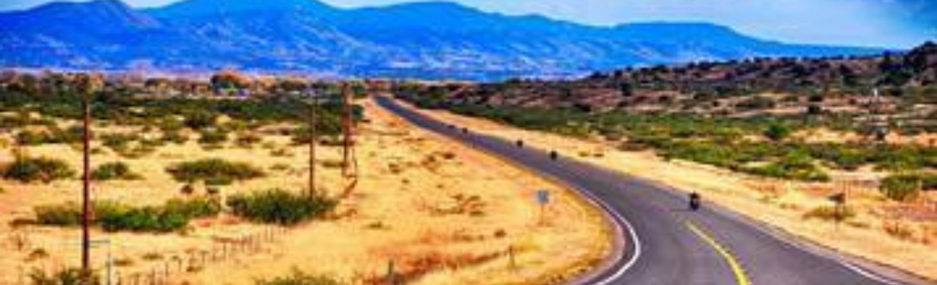
Starting out with a lot of driving. The first part is long drive down from Denver to Santa Rosa State Park. I am worried about the Raton Pass. This is the high point on the road where you cross from Colorado to New Mexico at over 8000 feet. There is a storm coming in the evening; I make it across the pass a little after noon and it is cold and windy but no snow or other weather. Driving mostly straight through, I get to Santa Rosa about 4 PM. The state park is about 15 miles outside the town at a dam and lake. As I approach, I can see that it is starting to get stormy and temperature that has not been above freezing all day is falling.
I find a pull through campsite that is behind the hill and set up the camper. I turn on the heat and I am so glad that I got that working on Friday as I don’t think this would be doable otherwise. I don’t see any other campers and there is a campsite host, but I am not sure that they are in their trailer for the night. Also, there is a limited phone connection, but I am able to send my wife Marci a text message.
I make dinner and read my book, but driving can be tiring. I turn the heat down to 45 degrees and go to bed at 8 PM! I have found that I am warm and cozy even with the heater turned low and I fall fast asleep. Around 5 AM I wake up when there is some increased wind that shakes the canvas and the camper a bit but I don’t think much of it. At 7:00 I open a window and there is an inch of snow all around and snow in the air. The roads are covered and I am worried that I have no connection and no one is here. I quickly got up and broke camp. I had not disconnected from the car, and it doesn’t take long to close up hook up the lights and be ready to leave.
January 8, 2024
Waking in the snow, I drive back into the town of Santa Rosa. This little town has leaned into having part of the old Highway 66 and the nostalgia surrounding that. The town is a little rough around the edges and I wonder if Highway 66 really resonates. I don’t care much about it and I am pretty sure younger people may not even recognize the concepts. On the internet I found a coffee shop with breakfast that has been highly rated, Mr. Bees. I am worried if they are open when I drive by. I found a parking space a out a block away and several inches of snow have fallen on the ground.
I get coffee and a breakfast bowl, remembering to ask for them to be light on the green chili. The weather has gotten worse north of Santa Rosa, and the Raton Pass is closed but south of Santa Rosa the weather is improving. I headed out toward Mountainair and the Salinas Pueblos National Monument.
These are three Pueblos that are in ruins, Abo, Quarai and Gran Quivira. Although humans have been in the area for more than 10,000 years, these sites are about 1000 years old. On the way I drive thought some saline lakes and salt pans that give the area its name. People have been gathering salt here for their on use and to trade with others. There is wonderful interpretation center in Mountainair that explains the story. In the 10th century when there is a drought the ancestral Puebloans moved into the Rio Grand valley and ultimately some groups crossed over into this area and figured out how to make a living. They learned how to practice dry land farming, hunting and gathering, and also started to trade salt for other goods with the Apache tribes on the plains and with the wider region. Ultimately, the population is estimated to have grown to 10,000 people. They also learned to build the complex above ground multi-room pueblos from the western region.
Around 1600 the Spanish from Mexico arrive and claim the land, treat the people as servants and bring Franciscans to convert them to Catholicism. This all started with the governor reading a proclamation to them, which none of them would have understood. The pueblos are occupied by the army and the church. The natives are forced to work for the governors and the Franciscans insist they build huge churches, convents and schools for them and learn to be “good” Catholics. There is resistance. Several plots are found out. Although there is a lot of illness, the Indians outnumber the Spanish and in 1690 there is a coordinated uprising, and the Spanish are forced completely out of the area and into El Paso. For the next ten years, the Pueblo rebuilt and reestablish their religion and rituals. The Spanish returned after 10 years, but by that time the pueblos were abandoned. In the 1900’s, this part of New Mexico is re-settled and these cities with a mixture of native buildings and huge ruined churches are rediscovered. Now they are a recorded of remarkable ability of humans to live in this rugged place and the dangers of first contact and conflict of cultures that leads quickly to destruction.
I go to visit the sites with the old building now covered with fresh snow. It is cold but I think that I will be warm enough with my modern jacket and heated car when the builders did so much with just their own hands.
I then drive on to Roswell and get to the Bottomless Lake Campgrounds a little before dark. Here it is more crowded and I get one of the last camping sites and set up as the light fades.
January 9, 2024
Awoke to a cold but clear day. I went out first to the Bitter Lake National Wildlife Refuge. I was able to take a drive out and then take a walk down to the Pecos River. There are some ducks still here, but the most impressive birds were Ferruginous Hawks. These are huge and rough-looking birds. They are the largest of the Hawks and the have feathers on their legs all the way down to the talons. They seem nearly as big as the Bald Eagle. There were at least 4 pairs that were flying over the refuge. It would be nice to come when there are more birds in the fall or spring; in September they have a Dragonfly Festival. They have over a 100 different species of Dragon and Damsel Flies that live in the refuge. This is amazing diversity.
There is a great interpretive center at the refuge and this helped me make sense of things. Off in the distance are snow covered mountains, called the Sacramento Range, and they are about 80 miles away. On the other side of the Sacramento Range is White Sands. Any water or rain that falls between Roswell and the tops of those mountains soak into the ground and enter an aquafer that flows downhill to the Pecos River which is the lowest point. Here water may come to the surface in springs and sink holes form and fill with water. This is why there is farming here in Roswell. The Bitter Lakes water is not actually from the Pecos, but are instead coming up from the ground.
At midday, I went to the UFO Museum and Research Library. This was more hoot and not that serious. In 1947 there was some sort of an incident and some people believed that an alien flying saucer crash landed and the government gathered up the crashed spaceship and four dead aliens and are now covering it up and denying it. I do believe that something crashed, but it was probably some US experimental plane. Of course, in the last years the DOD have released information that they have had numerous sightings of UFO and many are explained but a significant number are not. We just don’t know.
The town leans into the Flying Saucers with lots of touristy alien-themed businesses; even the McDonalds looks a bit like a spacecraft.
I had driven by this large industrial building that said it was the Anderson Museum of Contemporary Art. I stopped by and was blown away. Bob Anderson was an engineer and oil businessman who had come to Roswell after WWII and became very rich. He always wanted to be an artist himself and he did in fact paint somewhat abstract landscapes. In 1966, he started the Roswell Artist in Residence (RAIR) Program. They have a large ranch outside of town and on it he build 6 houses, 6 studios and some shared buildings for things like kilns, printing and other kinds of artwork. Since then every year they choose 6 artist to come, with their family if they have one and provide housing, a studio, supplies and a generous stipend. This museum is bursting with the art of now over 250 artist that have been RAIR awardees. The work is varied and amazing and in some ways too much to take in with all the different styles. The quality is amazing. Mr. Anderson recently died in 2021 at the age of 101! He funded the program indefinitely.
Later in the afternoon, I went back to the campground to make some dinner and chill.
January 10, 2024
Woke up and cooked breakfast and broke camp. I am getting pretty good at this and it doesn’t take that much time. The map offers me a drive that is some back roads and I take that one. It looks like so many of these places are wasting away. Many places look abandoned and those with people look a little broke down. I can see that many of the fields still have irrigation set up, there still are the orchards. But with more machinery it just doesn’t take as many people to farm this land. Ultimately, I get back to the main road and drove to Brantley Lake. The park does in fact have a good number of people who are camping here. My site is a pull through so I don’t have to worry about backing in to a spot. I have decided that I want to go the Sitting Bull Falls and the road to the mountain canyon is just across form the campground, so I head off. It is about a 30-minute drive and when I get up there the wind is really pounding. The wind is so strong that it is challenging to open or close a door and that you feel like you are being pushed around. It knew that winds could be a problem tomorrow, but I didn’t think it would be today too. I don’t feel that it safe to try to hike any here and I make a quick trip to see the falls which are icy and head out. The falls are an interesting situation. There is a spring up above the falls and the water pours out and then goes over the falls making travertine stone. There is a series of pools that people swim in during the summer. The stream only lasts for about a mile and then goes back under the ground. An amazing oasis.
I am now worried about the wind, and this might be too much for the camper with the top up. So I drive back to the campground and close the top. Checking in with the internet and Marci, it seems like it is not even the bad part yet! It is a good thing that tomorrow I will mostly be underground at Carlsbad Caverns. One of the other places I thought of going is under construction, so in the end I went to the local library. Was able to catch up on some emails and relax. On the other side of the building is the Carlsbad Museum and its free so why not? They had a visiting exhibition about guitars and their history. All very well done and interesting, but I found the history part the most compelling. There was an exhibit of the town heroes. Some were locals that had gone on to become famous: an NFL football player; an officer in the military; an assistant to Jim Henson that worked on Big Bird. However, most were heart warming stories of people who had stayed in Carlsbad and made a difference. The first Hispanic to be elected sheriff also started an organization called anonymous to provide Christmas gifts for children. He grew up poor and had often been disappointed with Christmas. I also learned about a woman that had been raised by parents who were traveling actors, she sometimes moved schools every few weeks. When she settled in Carlsbad, she went to the local university extension, earned a degree, and spent 40 years working with children in schools.
Their stories were heartwarming; they are heroes and I needed the exhibit to open my eyes.
I ate out- at a local restaurant and came back to the campground to get ready for the next day. I had lowered the roof part way but during the night the wind picked up and I had to get up and completely close the roof. The wind continued to be strong and the noise and shaking made it hard to sleep. In the morning the weather service was saying that the wind advisory would start at 9 AM with gust up to 80 miles an hour! We weren’t even under the warning yet.
11 January 2024
I got up and I didn’t feel like it was a good idea to put the top up so I couldn’t cook so I looked for foods I could eat cold and I would get coffee on the road. I was supposed to be at Carlsbad at 8:30 for a timed admission. The drive was pretty easy but when I got there the wind was gusting on the top of the mountain where the entrance is. Also my legs were hurting me, I have found it harder to do my PT exercises in the Cricket and with a lot of driving. I am wondering if I can do the walking for this but after about 15 minutes I am loosened up and I think I can go. I was here with my family on our western vacation 51 years ago but I just don’t remember anything about the park. Now they have timed entrance and then let up to 400 people in each hour and most people spend about 2 hours in the cave. I opt for the walk down from the natural entrance. This is a depression on the top of the mountain and then what looks like a shallow cave small cave. In the summer swarms of bats come out of the cave at sunset and people gather to witness this. This is what alerted a 19-year-old named Jimmy White that there might be a cave here. He ultimately began to explore and entered the cave. He made a ladder out of barbed wire and sticks to descend over a drop of 40 feet. From there he explored more of the cave over the next ten years. The cave descends 800 feet over 1 and ½ miles. Jimmy ultimately connected with a geologist who he took into the cave in 1923. He took pictures and there was story in National Geographic Magazine. The excitement lead to the president declaring the care a National Monument the next year.
On a cold and windy day, it looks like there may be only a few dozen who are entering the cave this hour and I am late starting because of my legs. For this reason I am alone, completely alone for most of the decent. A few people pass me by and I catch up to one group but I am enjoying the experience of having this space to myself that I hang back and hear and feel water drops and gaze in amazement.
At the bottom there is place with bathrooms, water and the elevator that can take you back up but first there is the Grand Rooms to visit in the cave. The size and height of the chambers is amazing. Everyone is talking in their library voice as the Ranger suggested. It does feel like a sacred space and you can take your time and slow down. I spent about 4 hours underground since I could take my time and at the end take the elevator up to the surface. Which empties into the gift shop…
There are exhibits that explain how the caverns formed but the explanations feel insufficient to the experience.
I know that there are some top side trails and things to do but bad floods last year damaged about half the trails and roads. I did drive down to Rattlesnake Springs which is to the south. From there you can look back on the Capitan Ridge, the remains of a huge barrier reef that formed about 250 million years ago. Now after erosion it rises 500 feet from the place I am standing. The entrance, which I can see is on the top and the caverns extend all the way down to my level and then hundreds of feet further down. It is isolated out here.
I come back to the campground and the wind is still gusty, not safe to open to the camper so I climb in and sit on the bed to write this story. Hoping I can sleep better tonight.
12 January 2024
When I woke up this morning, the wind had almost stopped. I had the top of the camper down and I had all the windows closed so I didn't realize that it was day time outside. I got up and made breakfast and broke camp for my drive to Alamogordo. The wind had been so strong during the night that it actually blew the chucks that I had on the wheels away. I was able to find them though. I am getting pretty good at breaking camp and so I was able to be on the road around 9:30 AM.
It was going to be about a desolate three-and a-half-hour drive. I started back towards Artesia and then turned West driving towards the Sacramento mountains. There really aren’t any towns to speak of for most of the way; I'm glad I had filled up on gas. One of the things that I noticed is that around the cities you can see plastic bags and other debris getting blown around and caught on the bushes; when you get out into the wilder areas it just looks so much cleaner. As I got closer to the Sacramento mountains, the road began to gain elevation and it became cooler outside. You start to see trees and clear water running in a stream that comes off the mountain, but the river probably disappears in the desert. As I got higher, there started to be snow on the ground and I even passed a small ski resort. Finally, I got to the town of Cloudcroft which was about 8500 feet above sea level. This was the high pass on this road. When you come over the pass you can see down into the valley 5000 feet below including the white sands. It is a relatively short drive down into the valley has it's much steeper on the West side so quickly we get out of the snow and the trees and enter a desert full of creosote bushes.
I'm camping tonight at the Lee Oliver memorial State Park. It is right up against the mountains with a nice view out over the valley. After setting up camp, I had heard that my granddaughter Amanda is not feeling very well and so I decided that I should stay within telephone service reach for the next day or so. I started off by visiting the small museum at Lee Oliver. Lee Oliver was born in 1865 and moved to this region when he was about 25 years old. Oliver lived the rest of his life here starting a ranch and founded the local town. The park was once a family ranch and his house is part of the park. One of the interesting things I learned about him was that he had been charged with murder when he was 32 of a man and his son, but that he was acquitted about a year later. When I mentioned this to the volunteer, she told me that they had never found the bodies of the two men that he had been accused of killing, and that was part of how he was acquitted. She also mentioned that they are planning to do renovations on his house this next summer; there's some speculation that maybe they'll find the bodies finally under the floorboards.
I then go to Pistachio Land: I found this place through the Atlas obscura, which is about 15 miles north and on the main road. Pistachio Land is marked by a huge 50-foot-tall pistachio nut made out of concrete and painted realistically to look like a pistachio. I've always liked pistachio so it was interesting to get to visit. There was a nice tour with a lot of information. They put up the large pistachio as a memorial to Mr. McGinn who had started the pistachio orchards in the early 80s. He died in 2007 and they put the statue up in 2008. He apparently was a sucker for those kinds of tourist things like the biggest ball of string or car hinge and so his kids thought that he would get a kick out of having the world's largest pistachio as his gravestone. Currently they have almost 400 acres planted in pistachio trees producing nearly half 1,000,000 lbs of pistachios every year. Pistachios originate from Iran; after the revolution the US hasn’t been able to import many because of the antagonistic relationship between countries. But according to our guide Josh, Mr. McGinn had obtained some pistachio seedlings that had been evacuated from Iran around the same time that the Shah of Iran had left the country. There were some adjustments with getting the trees to do well in this soil, but the hot, dry climate is similar to that of Iran and the trees only need about a half cup of water a week during the summer when they're growing. I remembered that Kip had told me that he had met the Shah of Iran, and I wonder if he had anything to do with bringing these pistachio seedlings over here that were the start of this amazing orchard. Of course, Pistachio Land has a store and I bought some pistachio candies for my mom and had an amazing cup of pistachio ice cream.
I returned to the campsite and I was able to have a small campfire and watch the sunset which was amazing with pinks and purples as the sun went down over the mountains on the other side of the valley.
13 January 2024
I didn't get to bed until late last night so I was late getting up this morning and it was cold inside the cricket; I usually turn the heat down to 45 when I go to bed. During the night, the propane gas tank had emptied and so the heater wasn't working and I had to get up in the cold and go out and turn to the new tank but quickly warmed up. I was surprised that we had used a whole tank of propane in just a week. However, I have been keeping the cricket warm particularly in the evening and I had to stay inside a lot longer than usual when it was so windy. My plan today his to visit the Tularosa Museum which had been closed last evening. I find these little museums in the towns in New Mexico are a great place to get a better understanding of the region. There was a nice exhibit that explained the formation of this region. It's thought that the valley basically dropped and this is why there's a sheer cliff and then a relatively flat valley. Apparently, this all happened about 60 million years ago, and that the valley floor was originally 5000 feet below the current valley which is now filled in with erosion. There is a lot of gypsum in these mountains and that washed into the valley. The gypsum dries out and then the wind picks it up and blows it into the white sand dunes. But people have been able to live here for up to 20,000 years. They find a way to make a life usually around the canyons that bring water down from the mountains and they use that or farm. There's this very narrow habitable zone. One of the things that they talked about was the Three Rivers petroglyph monument which was about 35 miles north of Alamogordo. It looked very interesting so I decided to explore up that area. Scott and Lori had wanted me to get some pecans and so I drove up to the little town of Tularosa which means pink water rushes in Spanish. Hispanic settlers had come into this region in the early 1800s and found a stream which they called tula Rosa and ultimately they built a community there and they have planted a lot of pecan trees and so I was able to find pecans for Scott and Lori. I also found a local bakery with Mexican pastries and delicious tacos and enchiladas, which I had for lunch, and I then continued north until I got to Three Rivers and went on a 3 1/2-mile hike looking and the amazing petroglyphs. About 1000 years ago, there were Native Americans living in that area and they made petroglyphs on a rock outcropping and now they've been studied and there's nearly 20,000. I sure didn't see 20,000 but I did see some of the best examples that I have seen with it being much easier to make out faces and animals like roadrunners mountain sheep and goats and the symbol of a sun which looks a lot like a cross. The people who made these petroglyphs left about 600 years ago and there's some clues that they may be the modern Zuni tribe.
On the way back, I couldn't resist stopping for another cup of pistachio ice cream and then made it back to the camp and had another campfire. The moon is very early and sets within an hour of sunset so it was a dark sky night and I could even make out a bit of the Milky Way.
14 January 2024
Today was my day to go to white sands National Monument. I had been to white sands 51 years ago when I was 15 years old. This was the summer that our families had traveled out West on our Great Western vacation. I don't really remember very much about the visit white sands is only about 20 miles outside of Alamogordo. I got there quickly and parked my car and the cricket RV in the parking area is for trailers. I went in to the welcome Center and watched the 15-minute video introducing the park and visited the exhibits that helps us better understand how the gypsum sand is formed how the dunes are formed and also the people who lived in the area. In the last few years it has been discovered that there are footprints of humans who were walking around the lake 23,000 years ago. Their tracks are interspersed with the tracts of mammoth great ground sloths and camels and horses. These discoveries have pushed backed the time at which humans first made it to the new North and South America by 10,000 years. After visiting the welcome center I also purchased a picture book for my mom. This has become a habit that I look for something that has lots of pictures that my mom can look at it home since she's not able to visit these places anymore.
I then went back out to my car and the cricket and drove on into the park; the first part has a paved road, and then the second half of the road becomes just gypsum. I didn't have any trouble driving even though I was pulling the cricket. I was able to stop at all the important trails and interpretive areas to really get a good understanding of how the dunes and the interdunal areas formed and the kinds of animals and plants that live in the region. I had my lunch in a picnic area and then walked part way out to the alkaline lakes. In doing so I experienced parts of the park that was not filled with visitors and dunes that were clear of the markings of footsteps.
Tonight, I will camp at the Aguire Springs Campground which is on the eastern slope of the Organ Mountains National Monument. The drive was a relatively short one across the basin and up into the range of mountains I have been looking past the White Sands. The campground is in a beautiful location at almost 7000 feet with the spires extending 2000 feet more just behind us. I am sure that this area is much more crowded in the warmer months. Today I was only one of three groups staying the night. The landscape is much greener with junipers and pinon with a mix of Live Oak trees that remind me of parts of the coast of California.
15 January 2024
Today I had planned to visit Las Cruces, but Marci called and asked me to come back home. I broke camp and drove on into Las Cruces, where I will get on the Interstate that will take me all the way home. It will take two days. I will make a note to come back down some day to spend more time at Organ Mountain and make my way over to Gila Cave Dwellings.